


The roading and footpaths group is the first of the mandatory groups. It is made up of 2 activities which have been split into separate subgroups to show their different funding arrangements.
Activity: Roading
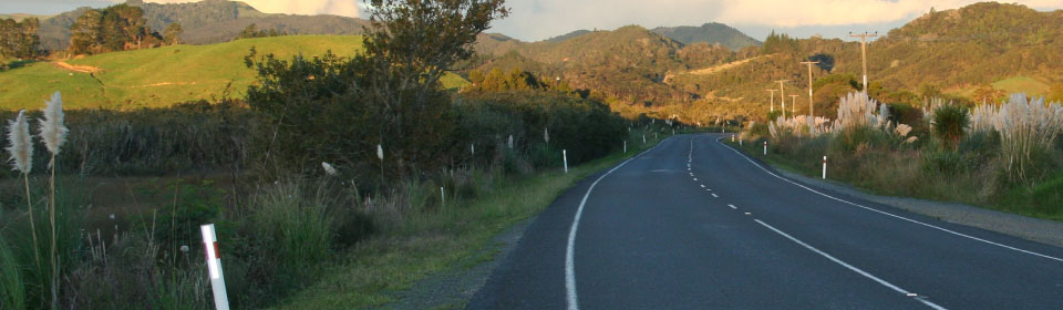
Council maintains and manages the local roading network including roads, street lighting, and signage.
Council’s vision is to provide an effective and sustainable road network that supports community strength and wellbeing.
The road network is a vital part of the district that enables safe and comfortable access for employment, personal/social activities and recreation, and the movement of goods and services. The transport network is essential to the functioning of the district’s economy, benefiting residents and the district as a whole. Maintaining and improving roads are regarded as two of the core functions of Council.
Key facts
Council operates and maintains a network of some 2,542 km which includes:
- 887 km of sealed roads.
- 1,665 km of unsealed roads.
- 714 bridges and large culverts.
- 1,632 streetlights.
- 628 minor structures (retaining and sea walls).
Council also:
- Operates 1 vehicular ferry, ‘Kohu Ra Tuarua’, on the Hokianga Harbour.
- Owns 7 inactive quarries.
- Receives an average of 260 Request for Service each month regarding the road network.
Our major achievements in 2012/13
Highlights of our progress during 2012/13 include:
- The Roading Business Unit was established 12 months ago and during the year had to establish a full administration operating system, a new accounting system, a new field operations system, developed relationships with new contractors operating in areas that were different, complete difficult legacy projects, helped contractors to understand a new performance based contract system and developed a monthly auditing system to support the performance based focus, respond to the substantial increase in logging related road movements and the resulting damage.
- Developed the Road Assessment and Maintenance Management System to a full electronic network integrated communications system.
- Cycle Trail work progressed on the three remaining sections of the cycleway. Actively growing engagement of Iwi with the Utakura Incorporation working with Council to provide access across working forestry land to ensure the Cycleway can get through to Horeke off road. The scenic views for cyclists on this leg of the trail will be outstanding. Ngati Hine is also revisiting their position to provide access through their forestry land to bypass the poor and largely uninteresting areas along Ngapipito Road. Work is progressing on bridge and track construction and clearing the track on multiple sections as part of an intensive effort to have the trail complete before the current tourist season.
- Significant progress has been made towards developing modern communication equipment linking the road maintenance contract teams into one central road asset management database managed by Council, using a cloud computing structure.
- Implemented a complete restructure of the long established street lighting programme introducing long life, energy efficient and a higher standard of lighting to the district. The change restructured the relationship with Top Energy, reduced margins, reduced the number of crews being charged to Council from 3 to 1, while progressively replaced all the lights at the ends of the network with long life light-emitting diode (LED) technology, effectively commencing a cost saving for Council of more than $600,000 over 20 years. Council took over the lighting registry from Top Energy and with a diligent programme of data cleansing removed 285 lights which we were being charged for, that either did not exist or were owned by others.
- Achieved a clean audit with New Zealand Transport Agency (NZTA).
- Completed a comprehensive audit of contractor performance against the level of service required in the contracts.
- A new method of working with the forestry sector was developed during the year with a wider level of information exchange and cost consequences explored, and with the developed forestry companies a shared expense environment approach has been developed. Formative work has been completed on the network using a ground-penetrating radar survey of some of the key forestry corridor roads with this indicating in most cases they are not fit for purpose and will require long term development to support the industry. A user pays method has been identified using electronic road user charging which is currently under development.
Challenges we experienced
- In September 2012 extensive damage was caused to the road network due to slips and slumping of roads and the high rate of damage caused by the continued logging activity through the winter months. Monitoring activity has shown that heavy vehicle traffic has increased by 50% this year on some roads with this traffic increase evident in the failure of the pavement.
- The Roading Business Unit team have succeeded despite many challenges facing them. The team has been handicapped by poorly performing data capture units that are now being replaced as they were not able to support the geographic information system requirements needed in the North due to the wide geography of the district. Despite these issues the team brought the budget in on target and the majority of planned works were achieved. Strengthening the team is a priority to ensure the gaps identified by management and NZTA are addressed.
- Three bridge replacement projects were not completed by June 2013 due to consultant and resource consent issues. Work to finalise the outstanding three 2012/13 bridges is expected to be completed in 2013/14.
- Road network reseals funds were regrettably reduced this year to provide funds for urgent repairs (metalling of damaged forestry roads).
Plans for the next 12 months
Capital Projects
- Continuing to work with NZTA towards upgrading the intersection of State Highway 10 (Waipapa Road/Waipapa Loop Road) to a roundabout and at the same time complete the link road between Kahikatearoa Road and Waipapa Loop Road (Klinac Lane).
Maintenance and Renewal
- Carrying out a minimum of 1% (approximately 8.5 km) of sealed road pavement rehabilitation (with associated improvements where applicable)*.
- Carrying out a minimum of 8% (approximately 70 km) of reseals.
- Maintaining and improving Tau Henare Drive, which is on Waitangi National Trust land.
- Carrying out replacement of the structural components on the following bridges:
- Blue Gorge Road E87 (Peria).
- Churtons Road C13 (Kaingaroa).
- Waikuku Road R07 (Waimate North).
- Hapanga Road L11 (Horeke).
- Tawata Road N03 (Waimatenui).
- Runaruna Road (Hokianga).
- West Coast Road (North Hokianga).
- Browns Road (Kaikohe).
Safety Improvements
- Completing a minimum of 20 minor safety improvements on the network targeted at reducing the number of crashes and severity of loss of control on bends.
- Maximising the amount of funding assistance for the Far North from the National Land Transport Fund.
- Supporting, subject to affordability, sealing projects where an element of local community contribution is available, and where the proposed project is in line with relevant Council policy.
Promoting Safer Driving
- Pursuing community programmes to raise awareness and educate communities about high risk issues such as drink driving, crashes on bends, speed, child restraint compliancy, and fatigue, in association with the New Zealand Transport Agency.
Ferry
- Continuing to operate Council’s ferry, Kohu Ra Tuarua, 7 days a week, 365 days a year.
- Continue to annually review fares to reduce operating losses and to meet unavoidable cost increases.
Pou Herenga Tai - Twin Coast Cycle Trail
- Stage 2 - Kaikohe to Kawakawa (22 km).
- Stage 3 - Okaihau to Horeke (25 km).
- Stage 4 - Kawakawa to Opua (11 km - Kawakawa Vintage Rail).
FNDC and New Zealand Transport Authority (NZTA) – Shared Services
- Develop a shared service approach with a Road Assessment and Maintenance Management System (RAMMS) use, potential adoption of Council road hierarchy in region, and common contracting approach.
* (For further information please refer to the Annual Plan 2013/14 “How is this plan different to year two of the Long-Term Plan” on page ^§^)